IDENTIFICATION AND LOCATION
The Viewpoints of La Siberia and La Pinguta del Morro are located in the surroundings of Tamurejo, within the territorial area of the La Siberia Biosphere Reserve. They constitute one of the municipality’s main scenic and hiking resources, allowing visitors to contemplate wide panoramic views of the urban centre, the surrounding sierras and much of the characteristic landscape of the region.
The route connects different observation points located around the hill known as “Pinguta del Morro”, an elevation near the urban centre that has become one of the visual landmarks of Tamurejo.
HISTORY AND TERRITORIAL CONTEXT
The route and viewpoints form part of the landscape and tourism enhancement actions carried out in the La Siberia Biosphere Reserve, with the aim of promoting knowledge of the territory and encouraging an orderly public use of the natural environment. The itinerary makes use of old traditional paths and historically used transit areas linked to the daily activity of the municipality, integrating urban, natural, and panoramic elements into a single circular route. The so-called Pinguta del Morro is one of the most recognizable topographic points in the surroundings of Tamurejo and serves as a natural balcony over the landscape of the region.
ROUTE DESCRIPTION
The route follows a circular path of approximately 6 kilometres, with an estimated duration of 1 hour and 35 minutes. The itinerary starts at Plaza del Pilar and continues through various streets and paths in the urban area until reaching the ascent to the Pinguta del Morro. Along the way, several representative spaces of Tamurejo and its immediate surroundings are crossed.
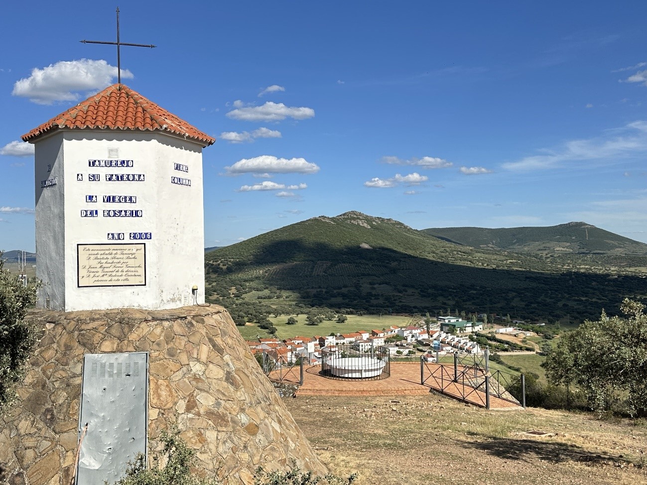
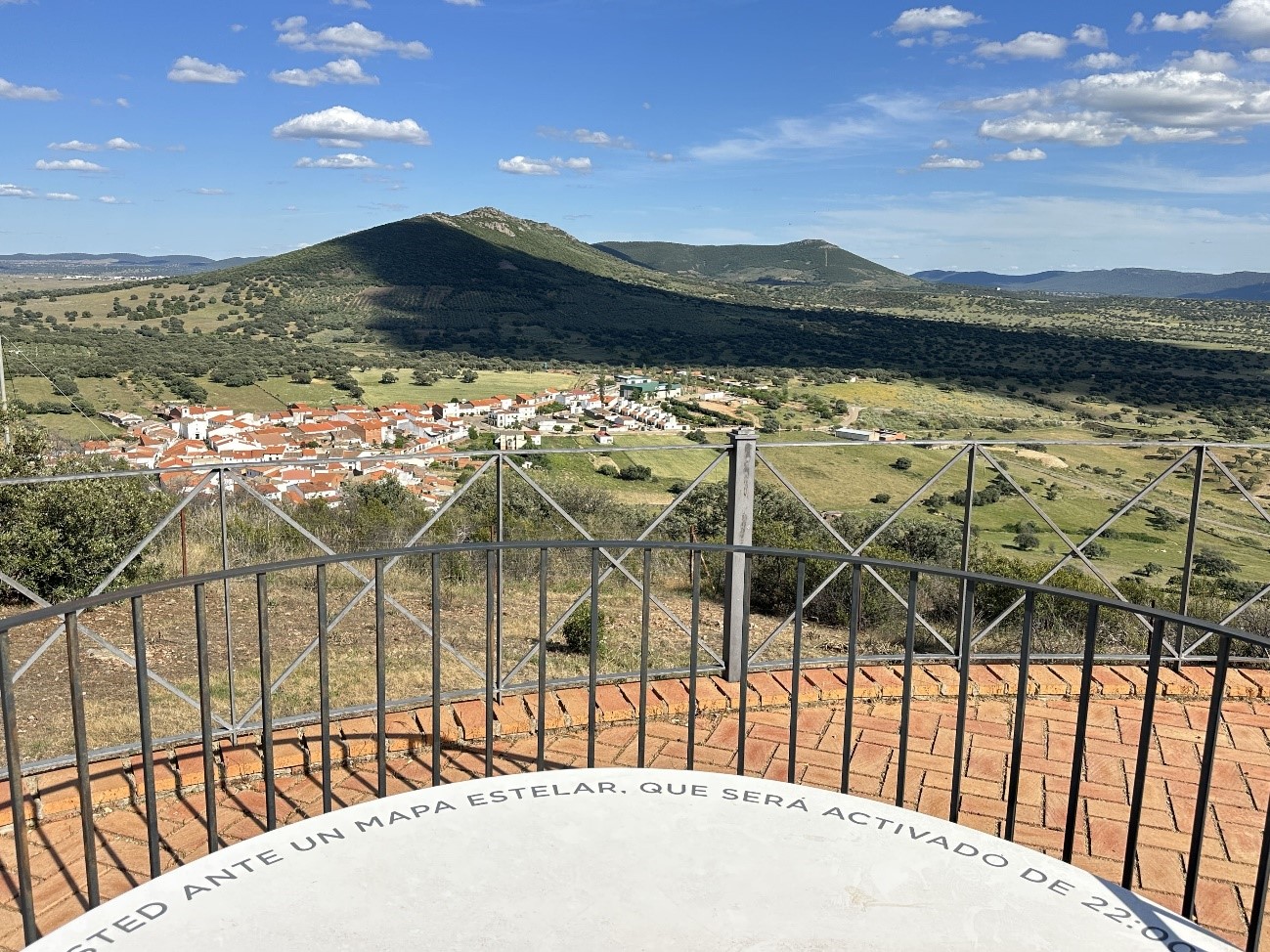
The final climb leads to the Mirador de La Pinguta, from which extensive panoramic views can be enjoyed of the town centre, the nearby mountain ranges, and much of the landscape of La Siberia. The route also allows visitors to observe the natural surroundings of the Hermitage of the Virgen del Rosario, as well as the nearby dehesa landscapes and Mediterranean scrubland areas close to the municipality.
HISTORICAL, ARTISTIC AND LANDSCAPE DESCRIPTION
The viewpoints are integrated into a natural environment characterised by gentle reliefs, dehesas and mountain elevations typical of the northeast of the province of Badajoz.
The Mirador de La Siberia offers wide perspectives over the territory and allows a visual interpretation of the characteristic landscape of the region, marked by the alternation between forest spaces, agricultural areas and small mountain elevations.
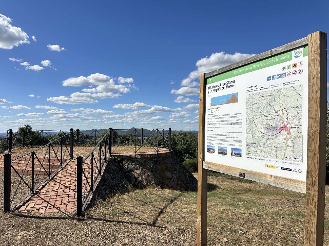
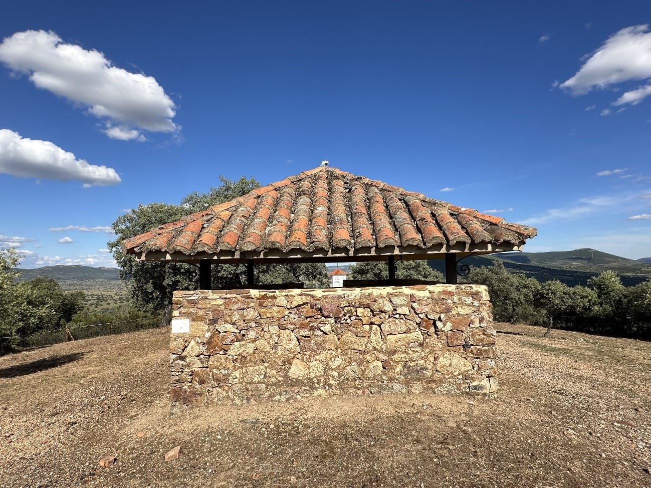
Meanwhile, the Mirador de la Pinguta del Morro is the highest and most representative point along the route. A viewing structure has been installed there, serving as a landscape observation point and a tourist resource linked to hiking and the appreciation of the natural surroundings.
From this enclave, panoramic views are obtained over Tamurejo, the surrounding sierras and wide sectors of the La Siberia Biosphere Reserve.
NATURAL RESOURCES
The surroundings of the viewpoints are integrated into a typical Mediterranean landscape of the La Siberia region, characterized by the presence of holm oaks, Mediterranean scrubland, and dehesa-like areas. The elevated position of the route also favors the observation of the relief and the transition between the mountainous areas and the nearby valley zones around the municipality. The site is of interest for hiking activities, landscape photography, and nature observation.
PUBLIC USE AND HIKING
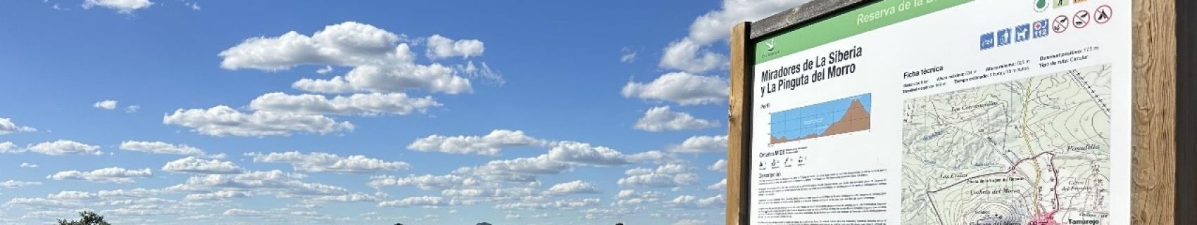
The route is signposted as a circular itinerary and includes interpretative panels and informative elements aimed at facilitating orientation and understanding of the route.
According to the technical information panel installed at the beginning of the itinerary, the route presents:
- Approximate distance: 6 km
- Maximum elevation: 634 m
- Minimum elevation: 505 m
- Positive elevation gain: 175 m
- Negative elevation loss: 169 m
- Estimated time: 1 hour and 35 minutes
- Type: circular route
The itinerary constitutes one of Tamurejo’s main active tourism and nature resources, integrating landscape, local heritage and natural spaces into a single interpretative route.